We invite you to get to know Chile through its culture, handicrafts, religion and traditions... In this section we offer you programs to get to know independent boutique vineyards and city tours. We also have sailing charters and cruises through the Patagonian channels if adventure is your thing.


Showing 1–16 of 17 results

Img 7911

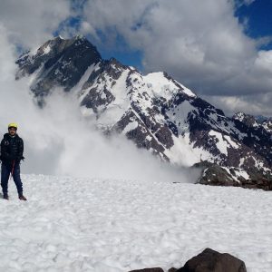
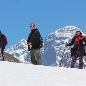
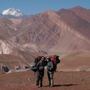
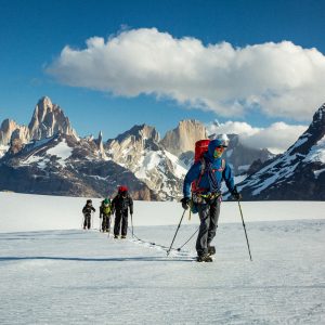
Southern Patagonian Ice Field / Marconi Pass – Wind Pass Expedition.
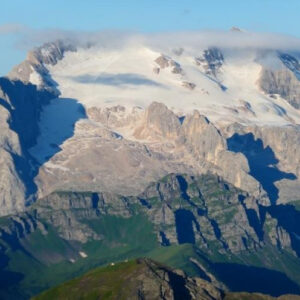
El Campo de Hielo Sur es la tercer masa de hielo mas grande del mundo luego de Antártida y Groenlandia. El Plato principal del Campo de hielo se encuentra a una altura de 1500 msnm y son alimentados por cuencas que descienden de grandes cerros como El Mariano Moreno, Volcán Lautaro, Pietrobelli, entre muchos otros. Este hielo que se va formando en las laderas fluye por los grande valles que son estas grandes planicies de hielo y siguen su recorrido hasta las zonas mas bajas de los valles formando lenguas glaciares como el Famoso Perito Moreno, Glaciar Viedma, Upsala, Pio XI, entre otros.
Allí en las zonas bajas de los valles los frentes glaciares llegan a los grandes lagos que están al Este de la cordillera como el Lago Argentino, Viedma, San Martin o hacia el Oeste descienden hasta el nivel del mar donde se terminan derritiendo.

Época recomendada: Octubre a Marzo
Dificultad: Media
Duración: 7 días (incluye día de emergencia).

Cerro El Plomo (5430m)

El Plomo Mountain

Conquer your first 5,000m! This circuit is ideal for beginners in high mountain climbing. El Plomo (5,430m) is an easily accessible summit, requiring no special skills or equipment—just a little goodwill and you're ready to go. This summit is ideal for preparing for a more difficult expedition (Tupungato, Aconcagua) and offers a privileged view of these future objectives.

Cerro Marmolejo (6108m)

Marmolejo Mountain

Marmolejo Mountain, 6,108 meters above sea level, is the southernmost 6,000-meter peak in the world, viewed from north to south; it is known for its close proximity from the route that runs through the Marmolejo estuary.

If seen from the north, you can see its vertical north wall falling into the abyss.

The scenic beauty of this mountain is given by its large glacial plateau which must be overcome to reach its highest point.

This mountain is within a volcanic complex, evidence of this are its neighbors San José Volcano and its different craters Espíritu Santo, Plantat.

Towards its slopes the volcanic evidence is hidden by large glacial masses (southeast slope).

Its cones are walls over 2000 meters high and are visible from Argentina.

The name Marmolejo was given in honor of the first Chilean historian Alonso de Gongora Marmolejo, who arrived in Chile in 1549 with Pedro de Valdivia.

Suitable Season: December to March.

Although in winter months this mountain is used to prepare large expeditions to the Himalayas.

It's important to keep in mind that during the summer season, as this is the highest point in the sector, it tends to become cloudy around midday, so you should be prepared for any inclement weather.

The Marmolejo is a tough test for any mountaineer, located in one of the most beautiful spots in the Central Andes.

CHILE, de Cordillera a Mar

CHILE, from the mountains to the sea

Our long and narrow country allows us to cross its entire width in one day. A journey through diverse landscapes hidden in the Andes mountain range, a lagoon surrounded by steep slopes, mountains, waterfalls, cliffs, and much more to discover in a wonderful Andean landscape at 2,880 meters above sea level.

Full day

Tipo tour tradicional , 6 hrs aprox.
Ubicación: Valle del Aconcagua y Cordillera de los Andes, Centro Internacional de Ski Portillo
Temporada: Todo el año
Mínimo de personas: 2
Grado dificultad: Altitud del hotel 2.880 m.s.n.m.
Restricción: Problemas cardiovasculares o relacionados con la altura.

Lospatos

Great Crossing of the Andes Expedition (Los Patos Pass)

Chile / Argentina 11 days / 10 nights

An extraordinary and fantastic journey through the Andes Mountains, rescued from history, following the same trails that the Liberation Army traveled in 1817 to liberate Chile from the Spanish monarchy. A beautiful journey, it is an expedition that crosses rivers, sharing with "huasos" and "gauchos" their typical muleteer customs and traditions, framed by the highest mountains in America: Mercedario (6,770 m) and Aconcagua (6,959 m), the highest on the continent, covered in glaciers and eternal snow.

During our tour, you'll discover the breathtaking landscape of our Andes Mountains, rugged and semi-arid in the lower reaches, and barren and stony in the snow-covered valleys. However, in the high-altitude valleys, the landscape is friendly, full of contrasts and life. Abundant wildlife can be seen, including guanacos, viscachas, and condors, keeping watch over their territory from the heights.

Senderismo Costero  Acantilados de Quirilluca  Maitencillo

Coastal Hiking Quirilluca Cliffs Maitencillo

The Quirilluca Cliffs are home to some of the Valparaíso Region's most iconic species, such as the sea otter and the Northern Belloto. The unique flora and fauna, combined with the unique landmarks found here, make this area a priority for preservation and conservation. The nesting of the common booby on these cliffs is unique in central continental Chile, and the sea otter (Chungungo) can also be observed from the cliffs themselves. The relict forest of the Quirilluca Ravine is home to the most coastal population of Northern Bellotos, a century-old tree that brings memories of bygone times to the landscape.

Trekking Cerro La Campana

Trekking La Campana Mountain

To reach the park, pass through Olmué, a picturesque town with a year-round microclimate. Hike and climb to La Campana National Park (1,890 m above sea level), a UNESCO World Biosphere Reserve.

From the summit, you'll find panoramic views of the Andes mountain range, Mount Aconcagua (6,959 m high), and the Pacific Ocean. The route passes through ravines and native forests of Peumo, Boldo Quillay, Oak, Sclerophyllum, and other species with incomparable aromas and freshness.

DISTANCIA 12 KM (IDA Y RETORNO)
DURACIÓN 8 horas aprox.
UBICACIÓN Olmué – Cordillera de la costa.
TEMPORADA Septiembre a Abril.
MÍNIMO DE PERSONAS 2 Pasajeros.
DIFICULTAD Trekking de intensidad moderada.
RESTRICCIONES Problemas cardiovasculares, lesiones en
recuperación, cirugías recientes, asma.
EDAD MÍNIMA 14 años

Trekking Cerro Mercedario y Balcón de los Seismiles

Trekking Cerro Mercedario and Balcony of the Six Thousand

Argentina 8 days / 7 nights

Balcony of the Six Thousand
From left to right: Ramada Street, Mesa Street, Pico Polaco Street, Mercedario Street

This expedition goes into the heart of the Ramada mountain range, in the Andes, located in Barreal, San Juan Province, Argentina. It is one of the most amazing areas of this Andean stronghold. In 1934, a large Polish expedition made the first ascents of these then still virgin mountains, whose altitude exceeds 6,000 meters. As a result, one of the most beautiful and celebrated stories and books in world mountaineering was written, called "Higher than the Condors."

On this journey, we'll share their typical muleteer customs and traditions with the gauchos. We'll encounter abundant birdlife and fauna along the way. Guanacos, vizcachas, and condors will be part of the landscape.

We will cross rivers and mountain passes until we reach the Balcony of the Six Thousand, a great amphitheater that opens at our feet, and then continue to the imposing southern wall of Monte Mercedario and its large hanging snowdrift that exceeds 2,000 meters in altitude.


Trekking Cristo Redentor

Trekking Christ the Redeemer

Climbing ancient paths used by the Incas, Spaniards, merchants and muleteers passing by the Inca lagoon and the Portillo winter resort is a journey that makes us relive one of the most important and significant feats for Chile and its liberation from the Spanish Monarchy as it happened in 1817. To see and learn about the old route of the trans-Andean train that crossed into Argentina is to admire a great work of engineering and an extraordinary and sacrificial human effort, now forgotten by the passage of time. To climb these paths wrapped in imposing mountains papered with letters written by history is to learn a little more about our roots and the overwhelming mountain geography that shelters us.

Upon reaching the highest point of the Bermejo Pass, a huge window will open up, surprising us with a majestic spectacle. Immense mountains over 5,000 meters high, such as Cº Tolosa and Sta Elena, will open up in front of us, as the balcony where we arrive will allow us to obtain an unbeatable view.

0001

Trekking Crossing the Andes (Piuquenes Pass)

Beginning of the Cajón del Maipo program in Chile and completion of the expedition in Mendoza (Argentina).
Temporada 2024/ 2025

We will embark on a path of singular beauty, traversing the Argentine Pass and the Piuquenes Pass, to cross the Andes and reach Chile. We will follow the path of those who bravely crossed these masses of rock and ice two centuries ago, joining the columns of the Army of the Andes under the command of General San Martín in 1817, as well as Charles Darwin in 1835.

Trekking El Enladrillado

Trekking El Enladrillado

El Enladrillado is perhaps the most famous natural attraction of the Altos de Lircay National Reserve, located in the San Clemente commune, Maule Region. Without a doubt, it is a unique place given its peculiar geography, the overwhelming beauty of the surroundings and also, the myths that surround it.

The favorite route of extraterrestrial beings
 

La ruta favorita de seres extraterrestres

Where does the name Enladrillado come from?

The answer to this question, often difficult or impossible to answer, is obvious in the case of this excursion: the surface of this plateau is covered by strange basaltic rock formations, resembling a series of "bricks" juxtaposed in an incredibly orderly fashion. While this phenomenon points to volcanic activity from bygone eras, its sterile, lunar-like surface—almost unnatural, one might say—has fueled the belief that it is actually a landing strip for visitors from other parts of the galaxy. Added to this is the large number of UFO sightings reported in recent decades, all of which has turned the Enladrillado into one of the most important centers of UFO tourism in Chile.

Trekking Laguna del Toro y Estero de las Gualtatas (3 días y 2 noches)

Trekking to Laguna del Toro and Estero de las Gualtatas (3 days and 2 nights)

3 days and 2 nights

One of the spectacular high altitude lagoons found in the central Andes mountain range is undoubtedly Laguna del Toro, located at 3,500 meters above sea level and nestled in the middle of Andean wetlands and with an excellent view of the Andes, making this location a good excuse to visit. To get there we must go through the Cajón de Los Ángeles, along a winding abandoned vehicle road that goes through the bottom of the access valley. We will pass through some small Maitenes forests until we reach Peldehuana, to continue climbing through large expanses of plains that will take us up the estuary until we reach Laguna del Toro.

Img 20231207 Wa0107

Trekking South Face Mount Aconcagua

Aconcagua Provincial Park takes its name from the highest peak in the Americas, Aconcagua ("Stone Sentinel" – 6,962 meters above sea level). The park preserves glaciers that give rise to rivers and valleys of incredible natural beauty. Mount Aconcagua was a ceremonial site for the Incas, which is why it is part of the "Qhapac Ñan" (Inca Trail) Andean road system, declared a World Heritage Site by UNESCO.

We offer a short 3-day trek through the Horcones Gorge, where we will spend 2 nights at the Confluencia Campground. We will hike to the Plaza Francia viewpoint, from where we will appreciate the South Face of Mount Aconcagua. The difficulty is medium. It requires adequate equipment, good physical condition, and basic mountaineering experience. It is suitable for those over 16 years of age. The entry permit to Aconcagua Provincial Park can be obtained from the Tourist Information Center at the Caballitos de Marly roundabout, General San Martín Park, Mendoza City. In this case, we will process it for you.

Trekking Valle de Flores, Herencia de los Glaciares

Trekking in the Valley of Flowers, Heritage of the Glaciers

6 Days and 5 Nights

The Central Andes were once covered in eternal snow, glaciers of enormous magnitude. With the transition from an glacial era to an interglacial period, geoforms, high-altitude lakes, and vegetation speciation unique to a high Andean region became visible. This is the legacy left by the glaciers, a trace of their stay and passage.

We will advance through small mountain valleys in the "Mesa Seca" range accompanied by our Staff and typical muleteers who will be in charge of organizing and preparing the pack mules and feeding them in the middle of a spectacular mountain setting. Finally, we will have the opportunity to go on kayak excursions to observe the birdlife of the area from a reasonable distance.

Trekking Vegas del Chano - Río Blanco - Los Andes

Trekking Vegas del Chano – Río Blanco – Los Andes

Enjoy a trek to Río Blanco through small mountain valleys accompanied by our team and traditional muleteers who will organize and prepare your meals in the midst of a spectacular mountain setting.

The excursion begins in Santiago, heading to the city of Los Andes. (For those coming from Viña del Mar or Valparaíso, meet at the Los Andes Bus Terminal.) The journey continues along the international highway leading to Mendoza. We will pass through beautiful mountain landscapes and picturesque towns surrounded by mountains and rivers. We then arrive in Río Blanco, where the trek begins to Potrero Alto and Vegas del Chano. This trek will take us through small mountain valleys accompanied by our staff and traditional muleteers, who will organize and prepare our meals in the midst of a spectacular mountain setting.